This message will be displayed across all pages
Mighty Oaks
  • Sign In
  • Home
  • Products
  • Industries
  • Services
  • Partners
  • Contact Us
  • Blog

Viewing blog posts for the category Science Projects

Recent Posts


  • ABM Canada 2022
  • Custom Products with MightyPlus
  • Mighty Oaks at CANSEC 2022 in Ottawa
  • Delvi Fulfillment Center Powered by Mighty Oaks
  • Mighty Raven Joint Venture

Categories


  • Advanced Solutions (12)
  • Archeology (6)
  • Event Management Solutions (3)
  • Events (15)
  • Grocery E-commerce (15)
  • Innovation (18)
  • IT Services (14)
  • Land Stewardship (8)
  • Locker Solutions (15)
  • Natural Resources (4)
  • NOC Operations (12)
  • Operations (9)
  • Science Projects (10)
  • Security (8)
  • Smart Retail (15)
  • Supply Chain (11)

Tag Cloud


  • Online Grocery Software
  • Smart Lockers
  • Omni-Channel Software
  • Omni-Channel Software BOPIS Pickup Lockers
  • e-commerce

Cedar Box Becomes Part of Meewasin-Mighty Oaks

FOR IMMEDIATE RELEASE ---  Victoria BC December 3, 2019  ----   Meewasin Analytics Inc, and Charles Burnett and Associates have entered into an agreement where Meewasin will take over the Cedar Box Apps business. 

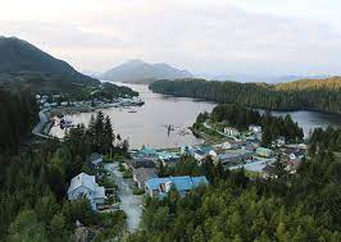
Cedar Box Apps was developed over nearly a decade by the team at Charles Barnett and Associates for the BC Costal First Nations communities.  The platform has been extended and used by other first nations communities in other regions of BC.

Read more...

Cedar Box Heritage App – Spring 2018 Upgrade

Cedar Interface

A new Cedar Apps features and fixes code push started in April with a focus on improvements to the Heritage App. We are extending the Community Map functionality, and continue to align Item fields with best practices standards (see links below).

Stay tuned for new web Documentation and PDF Guide in the coming months

Read more...

Agriculture Assessment Tool Launch at The Pacific Agriculture Show

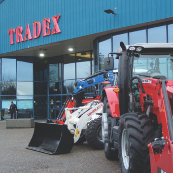
Mighty Oaks will be at Booth 853

The show will showcase the latest and most innovative equipment and technology for the agriculture industry. Join thousands of farmers and agri-food producers in comparing and investigating what over 250 dealers and manufacturers have to make your operation more efficient.

Read more...

CIRA Indigenous Laws Project - App Tour Kitasoo and Xa'xas Nations

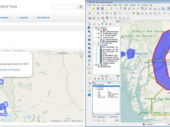
In the summer of 2015, Kitasoo/Xai’xais Nations joined the Indigenous Laws Project spearheaded by the Central Coast Indigenous Resource Alliance. Funding was found to hire 5 KX community researchers to work with 3 lawyers and assorted records management experts. A secure web application was built to house the resulting interactive database, a “Digital Archive”, of Collections, Items, Places and Case Briefs. As of Fall 2016, more than 1900 KX Items have been cataloged and ‘tagged’ using 50 different research fields—such as title, author, era, LUP theme, sensitivity, location, etc. These Items include maps, letters, charts, interview transcripts, books, photographs, reports, paintings, and carvings. The Items are grouped into 40 Collections, and have been collated into 29 Case Briefs. In addition, 201 Places have been identified.

Read more...

Presentation at the Society of Conservation GIS Conferance Monterrey 2016

SCGIS 2016 Conferance

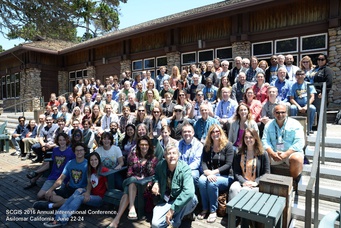
In June 2016, Charles presented at the Society of Conservation GIS Conference in Monterrey, California to speak about Cedar Box Apps. Scroll down to view the video of the talk. Or view the slides at http://www.slideshare.net/cnburnett/webgisbased-conservation-tools-for-first-nations-stewardship

Abstract
Marine stewardship in British Columbia is increasingly complex, contextualized by our First Nations? strong rights and title positions, and evolving co/management regimes. Small teams of fisheries managers, planners and technicians are being tasked with monitoring, assessment and planning tasks that would normally be the remit of well-staffed provincial departments. Over the last 10 years, First Nations stewardship managers have been searching for information systems that bring spatial analysis more efficiently and seamlessly into the day-to-day operations of all staff. Several decision-support systems have emerged using web-GIS technologies to address this challenge. Technically, these systems consist of: geodatabase back-ends (commonly PostGIS) and an HTML/JS/CSS front end, spatial libraries, and PHP or Python code. All of the systems do two key functions: (1) help to manage large cultural and ecosystem geodatabases, and (2) provide tools to mobilize the geo knowledge base in specific contexts such as: project/permit impact assessment, cumulative impacts assessment, compiling evidence to support legal cases. The geospatial analyses thus are varied: from proximity reports, to spatial modelling and visualization, to spatial key-phrase searches. Each system goes some way towards providing necessary efficiencies to stewardship office staff, but gaps remain. For example, the following features would be useful when incorporated: secure links to government databases, incorporating management tools outside of conservation (fee-simple lands, environmental management), mobilizing knowledge for schools, managing field survey data, and stewardship staff time-tracking and billing.

FYI: Also participating were ~20 young international scholars doing amazing work around the world: http://www.conservationgis.org/scgis/2016/ScgIntl2016A.html

Read more...
  • ←
  • 1
  • 2
  • →
Home
  • Privacy Policy
  • Terms Of Service
Customer Service
  • Request A Demo
  • Network Operations
About Us
  • Blog
  • Community
  • Contact Us
  • Meewasin
Contact Us

250 386 9398 | support@mightyoaks.com

© 2022 Mighty Oaks All Rights Reserved. Powered by Mighty Oaks
Menu
Your Cart
Empty Cart
Are you sure you want to empty the cart?
Create a new list
Delete the list
Added product to list